A Trek through Glen Nevis and the Water of Nevis
Trekking Through Glen Nevis
Glen Nevis runs south and then east out of Fort William. It's beautiful and easily accessed, so it has been used as a location for scenes in Braveheart, Rob Roy, Highlander, the Harry Potter movies, and others. Let's walk from Fort William up Glen Nevis, around the base of Ben Nevis, up the steep valley Eas an Tuill, onto the Highland moors by the An Steall waterfall.
Fort William, known in Scottish Gaelic as An Gearasdan, is along Loch Linnhe, the narrow waterway seen on this map as passing close to Ben Nevis, the highest peak in Scotland at 1344 meters.
Loch Linnhe, Loch Lochy, and Loch Ness form the Great Glen running southwest to northeast all the way across northern Scotland.
Loch Linnhe opens into the sea, and is the longest sea loch in Scotland.
Ben Nevis is a mountain on one side of Glen Nevis, the River Nevis runs down the glen to empty into Loch Linnhe at Fort William.
See my page about an ascent of Ben Nevis for details on it.
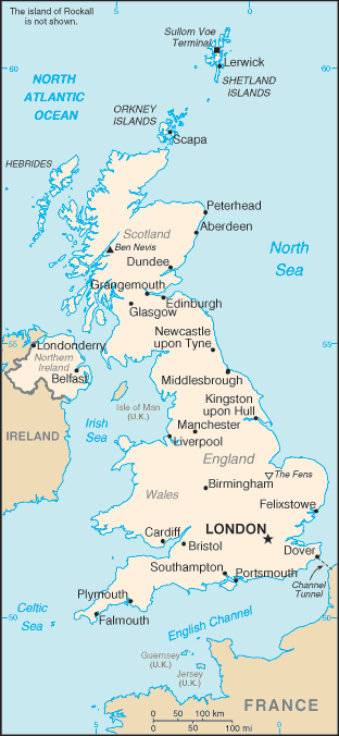
Glen Nevis is in Scotland, where the mountain Ben Nevis appears.
The UK uses a unique National Grid Reference System, and you need to understand how it works to benefit from the Ordnance Survey maps. See my page for an explanation if needed.
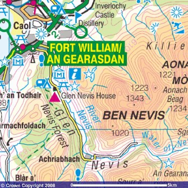
Glen Nevis runs roughly south from Fort William past Meall an t-Suidhe and Ben Nevis. It then turns to the east and climbs gently as far as the road (yellow) is shown on this 1:250,000 Ordnance Survey map. It then climbs more steeply into a high valley.
You will definitely want to buy a quality Ordnance Survey map, at least 1:50,000 and more likely the more detailed 1:25,000 version. They're available in shops and the TIC (Tourist Information Center) in Fort William. Bigger bookstores in Edinburgh carry OS maps for all Scotland, and a few in London even have them for all of the U.K. I used the Explorer 392 map, titled "Ben Nevis & Fort William; The Mamores & The Grey Corries; Kinlochleven & Spean Bridge."
Amazon
ASIN: 031946802X
There is a two-lane road through the northern part of the Glen. There is a campground, a couple of pubs, and a youth hostel (the red triangle) in the northernmost two kilometers of the glen. The pub along the road is the Glen Nevis House, an oddly early 1970s hipster lounge-bar where Dean Martin would hang out while taking a break from trekking through the Highlands. That is, if Dean Martin ever trekked through the Highlands.
The hostel, where a steep path climbs to join the Ben Nevis summit path, is the last business along the road.
There are nice paths through the Nevis Forest, including parts of the long-distance West Highland Way.
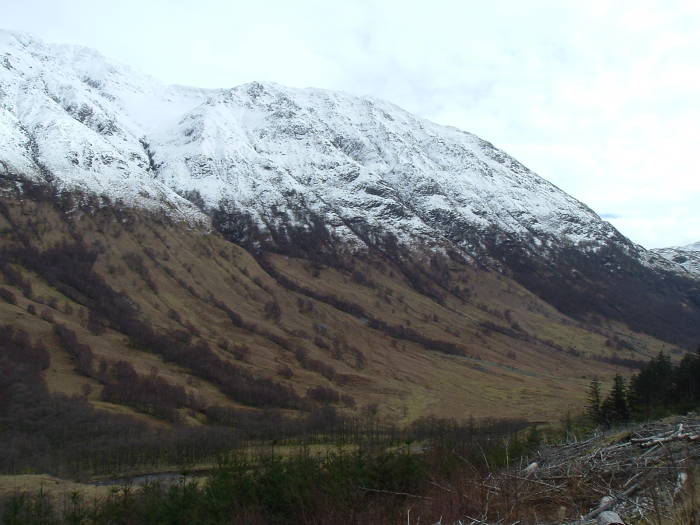
Well, mostly nice — in places the paths have to cross clear-cut sections which are bleakly forest-industrial.
The path winds back down out of the forest to join the road near the farm Achriabhach. At that point the road narrows to a single lane as it crosses the falls. That was 10.8 kilometers from where I started at the Fort William Backpackers hostel, given the route I took along the forest paths.
I think it's at the falls of Achriabhach that the Water of Nevis becomes the River Nevis. It quickly gets larger as it flows, as many small streams feed it on both sides with runoff from the surrounding mountains.
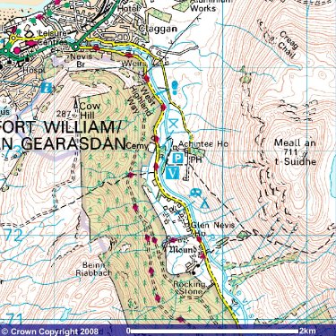
Follow the road to its end at a parking area. That's 2.8 kilometers from the falls of Achriabhach, or 13.6 km from Fort William. The path continues straight ahead, up a steep slope above the Water of Nevis.
The Water and the path make a right-angle turn. You climb a steep valley named Eas an Tuill. The Water of Nevis is tumbling down a series of falls with about a 100 meter drop over the course of one kilometer. Eas an Tuill is between Meall Cumhann to its northeast and Cathar na Seilge to its southwest.
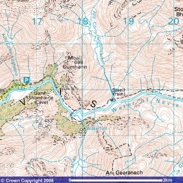
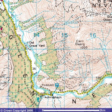
The narrow valley opens out dramatically as you climb out of Eas an Tuill. Ahead and to your right are mountains with the waterfall An Steall nearby.
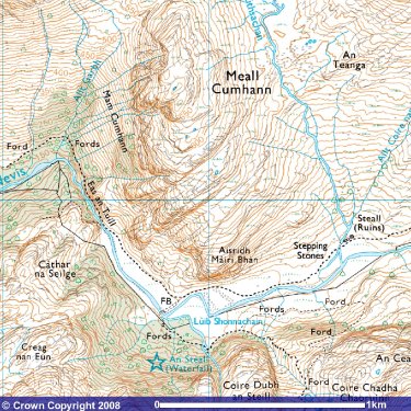
This 1:25,000 map shows more detail than the 1:50,000 maps above.
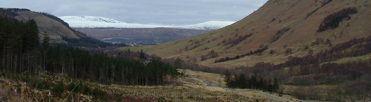
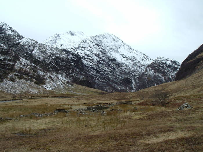
The valley turns to the left, more or less due east, and you're in a high and wide mountain valley. The ruins of the settlement of Steall are nearby. Paths continue west across the Highlands toward Corrour.
Steall is about 16.7 kilometers from Fort William, so that was my turnaround point. That made for over 33 km, a long enough day.
Pictures
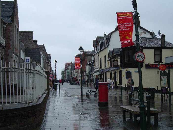
I'm starting out from the High Street through the center of Fort William, near the head of Loch Linnhe. This is the second-largest settlement in the Highlands, after Inverness. However, Fort William has a population of just 9,908 and so it doesn't feel like a city at all. Despite its size, it's definitely a Highlands town. Over 7% of the population could speak Gaelic in 2006.
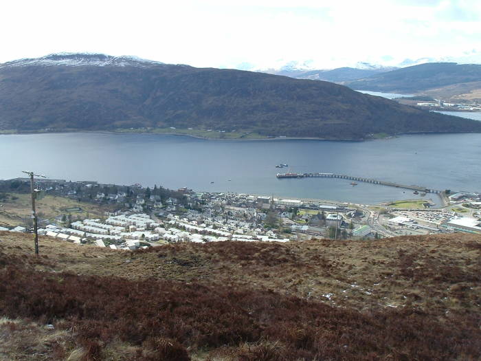
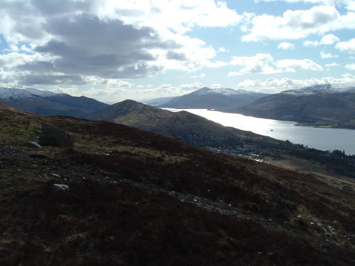
I've climbed Cow Hill, 287 meters elevation, just behind the town and am looking down on Fort William and Loch Linnhe, and just visible in the distance, Loch Eil.
Here I have turned to my left to look southwest down Loch Linnhe toward where it opens into the sea.
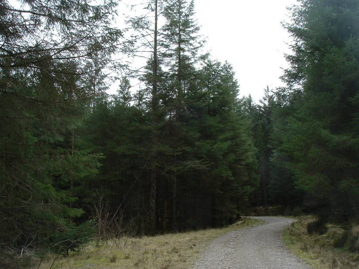
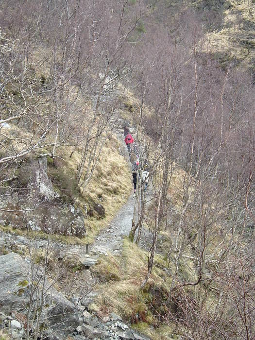
A broad path, really a gravel lane, leads south through Nevis Forest.
The West Highland Way is a long-distance path through Scotland. This lane forms a part of it.
The long-distance paths are marked with green diamonds on OS maps.
Looking across Glen Nevis toward the west side of Meall an t-Suidhe (711 meters).
Looking back down Glen Nevis toward Fort William and the north, Cow Hill (287m) is at left and Meall an t-Suidhe (711m) is at right.
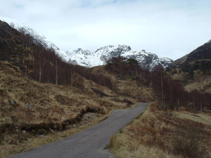
Looking southeast up Glen Nevis and the southwestern slopes of Ben Nevis (1344m).
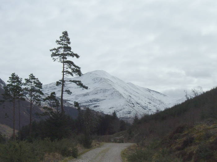
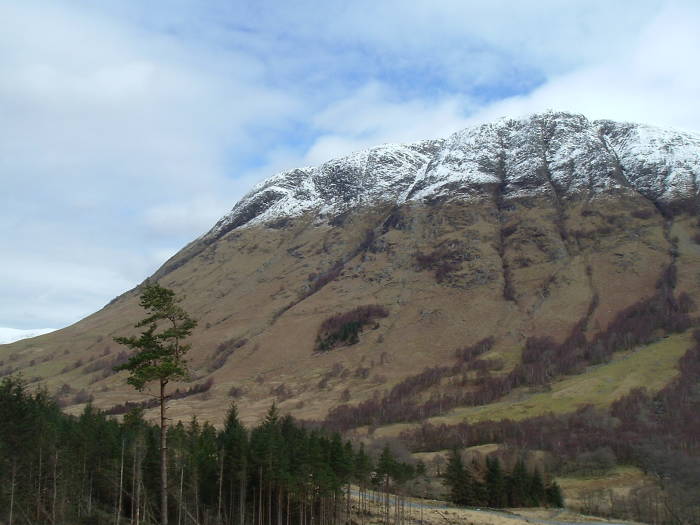
Looking south along the path toward Stob Bàn (999m), which lies south of where Glen Nevis bends to the east.
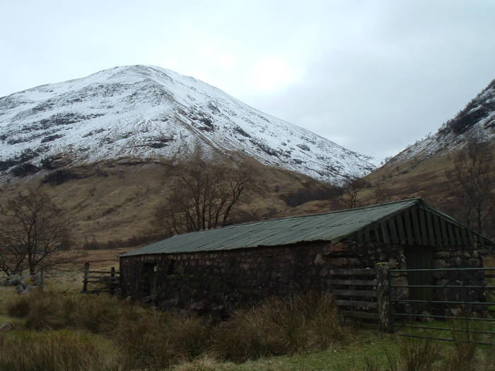
Achriabhach is in front of Stob Bàn.
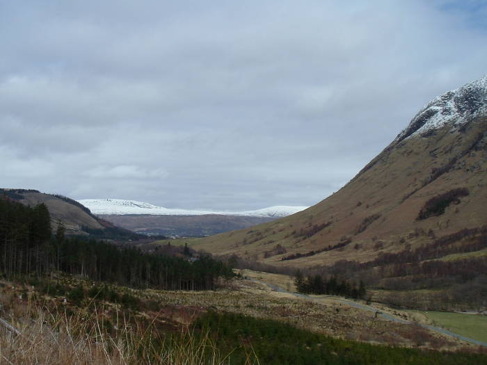
We're at NN 1450 6840 in the National Grid system, about 11 km from town and at an elevation just about 50m.
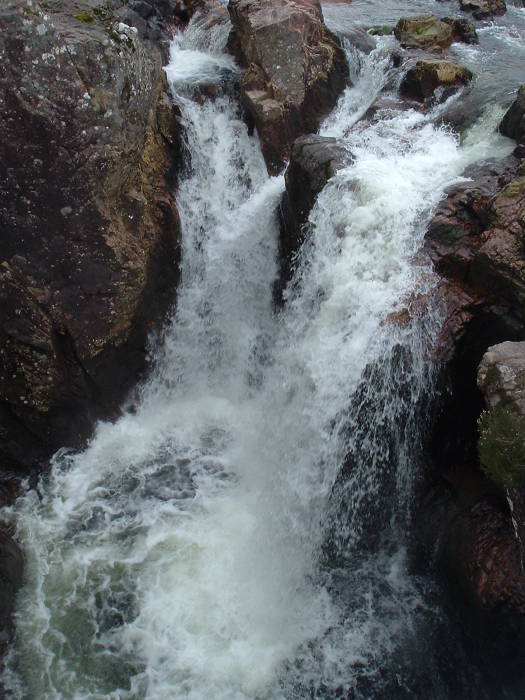
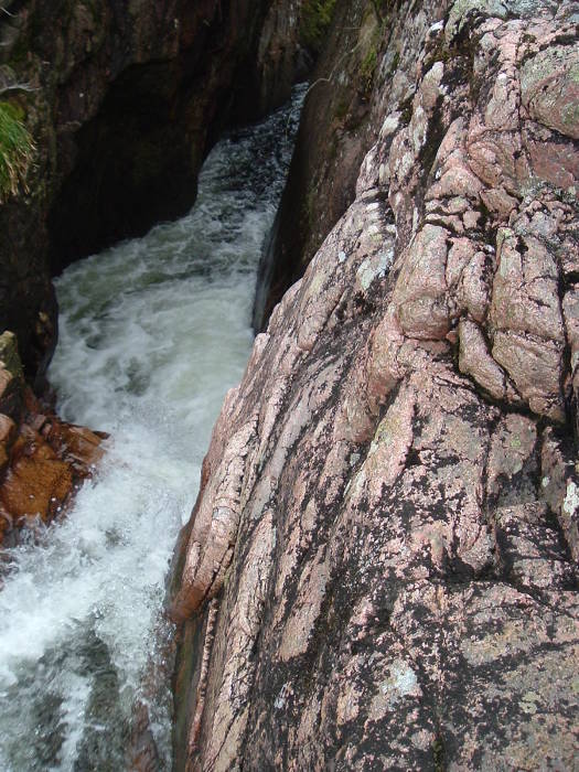
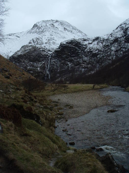
The Water of Nevis comes down over the Falls of Achriabhach.
Below this point the stream is called the River of Nevis, above here it is called the Water of Nevis.
The lane leads onward to the parking area in upper Glen Nevis. The cark park is at NN 1675 6920, another 2.8 km from Achriabhach.
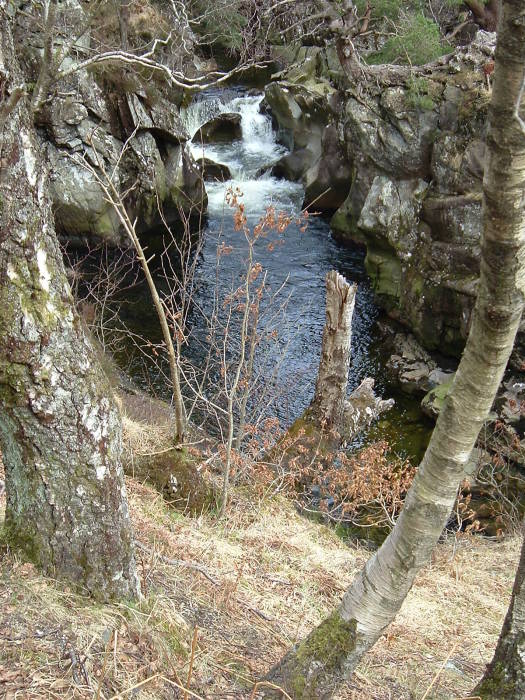
There are smaller falls all along the Water of Nevis.
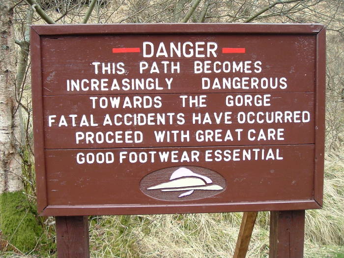
Well, you do need to be careful.
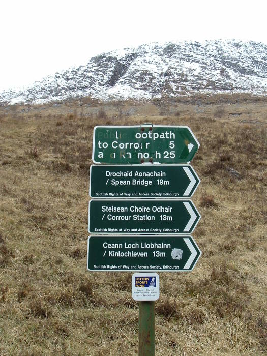
Signs mark paths to various destinations, in both Scots Gaelic and English:
Drochaid Aonachain
Spean Bridge
Steisean Choire Odhair
Corrour Station
Ceann Loch Liobhainn
Kinlochlevin
To give you some idea of Scots spelling and pronunciation, the second two destinations are intended to be pronounced the same way in either spelling.
That is, steisean is station, Choire Odhair is pronounced roughly like Corrour, and Kinlochleven is just the English spelling of Ceann Loch Liobhainn.
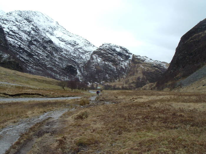
We'll keep following the path up the valley Eas an Tuill.

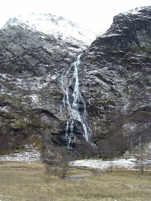
Coming out of the upper end of Eas an Tuill, the waterfall An Steall is straight ahead, It comes down from An Gearanach (982m).
This is the view from around NN 1730 6880, elevation about 210m.
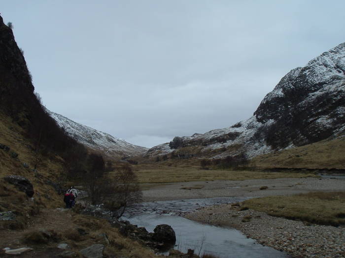
The valley curves around to your left. It runs roughly east across the moors to Corrour Station.
The scale of things here makes the pictures of An Steall waterfall look far less impressive than the reality. The waterfall is 105 meters tall.
It's at NN 1800 6820, elevation about 250m at the base.
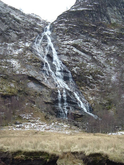
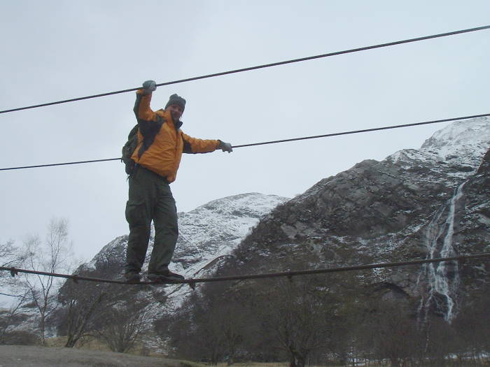
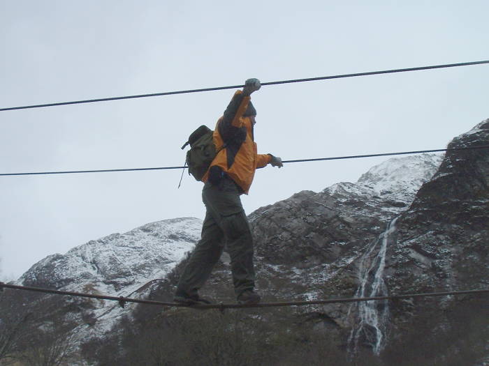
You have to cross the Water of Nevis to get closer to An Steall.
Here is the view across the footbridge — a three-cable bridge.
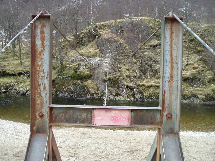
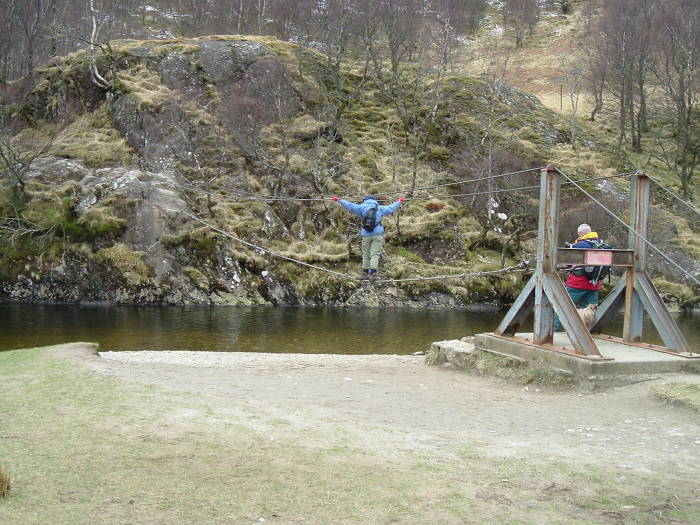
One cable to walk on, one for each hand.
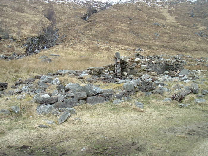
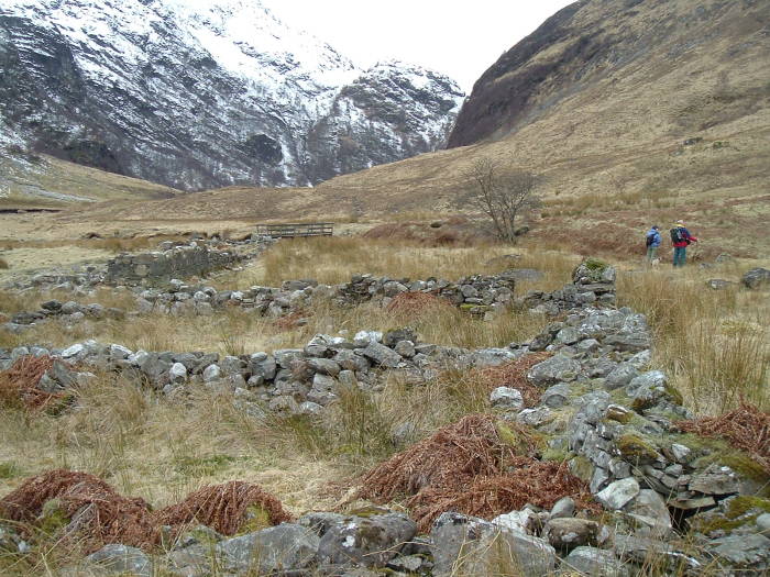
These are the ruins of the settlement of Steall.
It was abandoned in the Highland clearances.
NN 1875 6880, about 17 km from Fort William, elevation about 230m.
Here's a view from beyond Steall, looking back west over Steall and toward the lower glen.
Other hikers explore Steall.
We're starting back toward Fort William.
This area is very boggy. There are firm paths, but in places you have to pass through soft and wet areas.
For lots of pictures and a description of just how boggy, see my overland trek across the high moors and mountain valleys from Corrour Station through here and on to Fort William along The Road To The Isles.
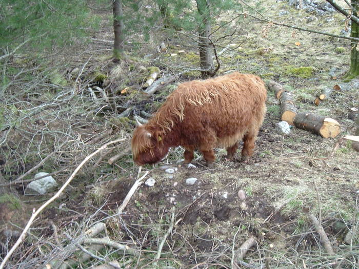
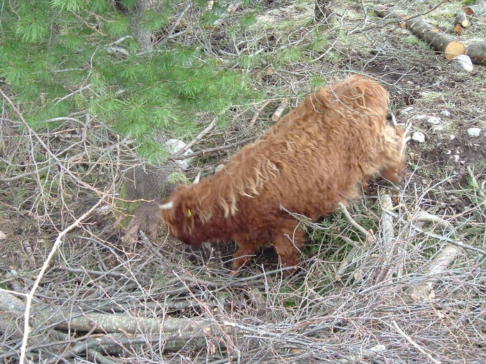
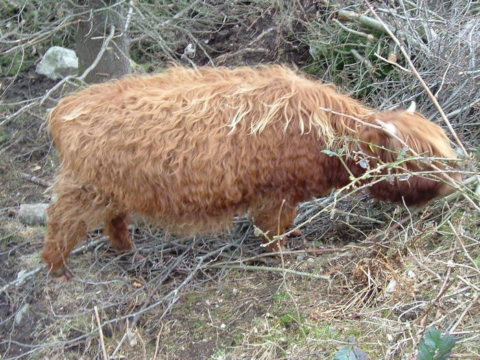
Hurry coos!
Or, as you might call them, hairy cows.
Shaggy Highland cattle.
You can see some of these in the lower Glen Nevis.
They seem to be very reasonable creatures.
They're the sort of animal you might find in nature, as compared to the genetic dead-ends of industrially raised cattle.
Plus, they look like something out of the last Ice Age.