Scapa Flow and the Churchill Barriers
Scapa Flow
Scapa Flow, an excellent natural harbor in the Orkney Islands to the north of Scotland, was a major Royal Navy base during both World Wars. The traditional naval bases along the southern coast were threatened by the increasing threat of attack by air. In the early months of World War Two, a German submarine slipped into Scapa Flow and sank the HMS Royal Oak, killing 833 men out of its crew of 1,400. Winston Churchill was the First Lord of the Admiralty at the time, and he ordered that causeways be constructed to block most of the eastern approaches. These causeways came to be called the Churchill Barriers, and today they provide road links connecting several islands. Let's visit Orkney and see what remains of the Churchill Barriers and other war-time defenses!
Amazon
ASIN: 0319466922
Amazon
ASIN: 0319228126
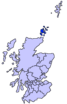
Map of Scotland, Orkney (highlighted), and Shetland, further north.
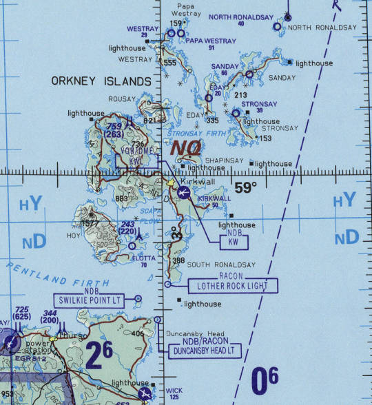
Where is Orkney?
The Orkney Islands, also called simply Orkney, are just off the northern coast of Scotland.
The terminology can be confusing — you leave the mainland of Europe for Britain. Once you have traveled the length of Britain, you leave the mainland of northern Scotland for Orkeny. And once you get to Orkney, you find that the largest island is named Mainland.
Everything is relative.
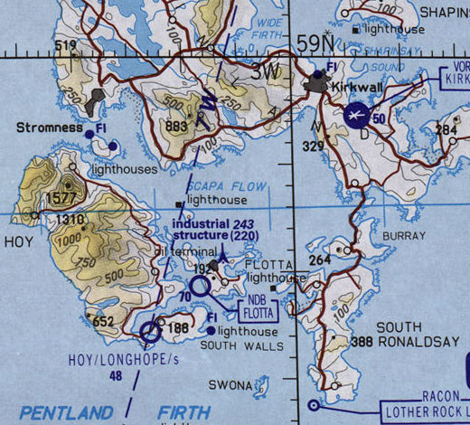
There is a great natural harbor surrounded by the major islands of Mainland, Hoy, and South Ronaldsay, plus the smaller islands of Burray, Flotta, and other lesser islands or holms.
Ah yes, holms. Orkney was settled by the Norse, and many Norse place names and geographical terms persist. Including holm for a small island. Norn, a Norse dialect, was spoken on Shetland and Orkney at least through the late 1700s. The Norse terms live on in place names, geographical terms, and local fishing vocabulary. You also see -ay as a suffix indicating a larger island (such as Burray, Ronaldsay, etc); ness and taing for "point"; nev or nevi for "headland" (from the old Norse for "nose"); geo for a steep-sided narrow bay, typically cut into a cliff; noust for a wider bay; and skerry for rocks just at or above sea level.
That large natural harbor was known as Skalpaflói to the Norse, meaning bay of the long isthmus. Today Skalpaflói is rendered as Scapa Flow in English. Viking raiders made Orkney their headquarters by the 800s. Harold Hårfagre, or "Fair Hair", subdued the raiders and annexed Orkney and Shetland (even further northeast from Orkney) to Norway in 875.
The 11th century Orkneyinga Saga and later texts including the Saga Hákonar Hákonarsonar describe the Viking expeditions in detail. The Saga Hákonar Hákonarsonar tells how King Haakon IV of Norway anchored his fleet at St Margaret's Hope, where he and his men witnessed an eclipse of the sun. They then sailed south to the Battle of Largs. On his way home he anchored some of his fleet in Skalpaflói for the winter, but he died in December while staying at the Bishop's Palace in Kirkwall. In 1468 the Norwegian king Christian I pledged Orkney and Shetland to James III of Scotland as dowry for his daughter Margaret.
Amazon
ASIN: 0140443835
Amazon
ASIN: 1278236821
Orkney's location provided a head start for trips to the North American colonies. The Hudson Bay Company, the de facto government for large parts of North America including much of today's Canada, was based in Orkney.
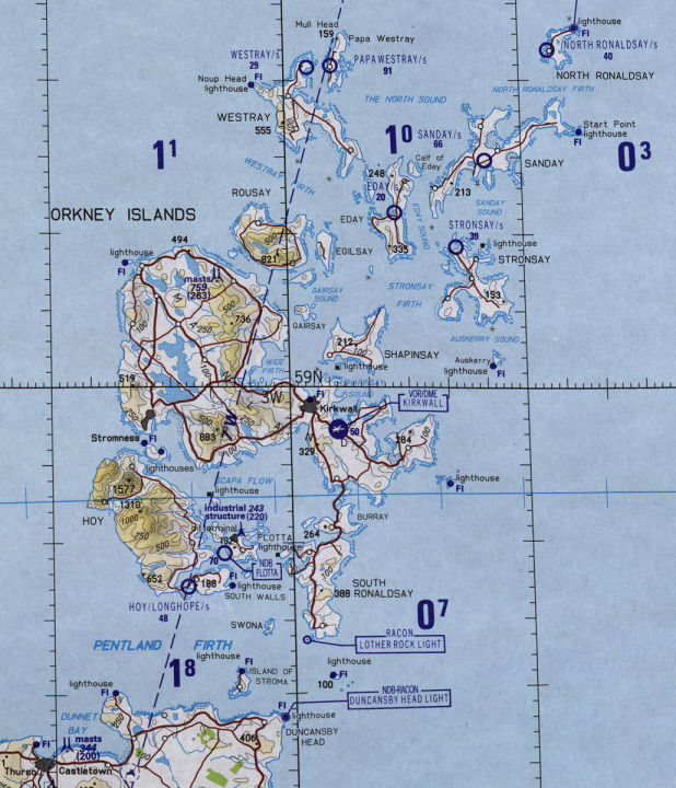
Today, the Churchill Barriers carry the A961 road running south from Kirkwall on Mainland across small holms and the islands of Burray and South Ronaldsay to Lothar Rock Light.
Scapa Flow was a major naval base for the Royal Navy in both World War I and World War II. Scapa Flow includes more than 225 square kilometers of sheltered water with a sandy bottom no deeper than about 50 meters and mostly about 20 to 25 meters. It had been good for the Vikings, and was great for the Royal Navy.
Britain's primary naval bases had traditionally been located along the south coast of England, with relatively easy communication with London and close to the usual naval foes of France, the Netherlands, and Spain. But the 20th Century brought improved long-distance communication and the increasing threat of attack by air.
The German High Seas Fleet was building up, and in 1904 the Royal Navy decided that a northern base was needed. A base in Orkney could better attempt to keep the German fleet confined to the North Sea.
Admiral Jellicoe was worried about German submarine or destroyer attacks on Scapa Flow, and the base came to be heavily defended with concrete barriers, minefields, and artillery. There were only two attempts by U-boats to enter Scapa Flow during the First World War. The U-18 tried to enter it in November 1914, but a trawler searching for submarines rammed the sub, causing it to flee and then sink. The UB-116 made the only other attempt, in October 1918 just before the end of the war. The UB-116 was detected by hydrophones and destroyed by shore-triggered mines.
After World War I, Germany presented a problem for the rest of the world. What was to be done with the German High Seas Fleet? No one wanted Germany to have a powerful naval fleet, but at the same time no one wanted to deal with the problem. Meanwhile, France and Italy each wanted a quarter of the German fleet, and that would hurt Britain's current naval advantage.
The entire German fleet had surrendered, and the surface ships moved to Scapa Flow by the end of November, 1918. German skeleton crews were kept on board the fleet for needed maintenance and storage operation — keep the bilges pumped out and so on. Meanwhile, the fate of the fleet was negotiated at the Paris Peace Conference.
On 21 June 1919, the German commanding officer signaled the ships to scuttle themselves. The crews opened the seacocks and allowed the ships to flood and sink. They had already loosened portholes, welded waterproof doors and hatches so they couldn't be closed, and drilled holes through bulkheads. Vital handles and tools had been dropped overboard so valves could not be closed. Out of the 74 German ships, 15 out of the 16 capital ships (that is, battleships and battlecruisers), 5 out of the 8 cruisers, and 32 out of the 50 destroyers were sunk.
Amazon
ASIN: 1591142598
Amazon
ASIN: 1405007850
The British Admiral Wemyss said, "I look upon the sinking of the German fleet as a real blessing. It disposes once and for all the thorny question of the redistribution of these ships."
The German Admiral Reinhard Scheer said, "I rejoice. The stain of surrender has been wiped from the escutcheon of the German Fleet. The sinking of these ships has proved that the spirit of the fleet is not dead. This last act is true to the best traditions of the German navy."
During the years before Germany started World War II, while Germany was rebuilding its fleet largely from scratch, British entrepreneurs salvaged most of the WWI German fleet. The German crews had opened the sea-cocks but not damaged the hulls. Divers could plug the holes, and then pump air into the hulls and re-float the ships. They generally floated to the surface upside down, but that was fine as the intent was simply to beach them or tow them south to shipyards around Edinburgh and re-use their steel.
The remaining wrecks are in deeper water, 45 to 50 meters below the surface, and remain as attractive diving sites. Scuba divers can now visit the battleships König, Kronprinz Wilhelm, and Markgraf, and the heavy cruisers Brummer, Dresden, Köln, and Karlsruhe. Underwater visibility is pretty good — I shared a room with a diver who said that the big ships become visible when you're about halfway down to their depth.
Amazon
ASIN: 1905492308
Amazon
ASIN: 1849952906
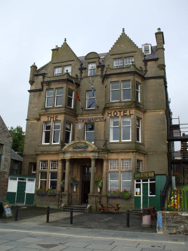
The Stromness Hotel in the port town of Stromness. This was the headquarters during World War II of OS DEF: Orkney & Shetland Defence.
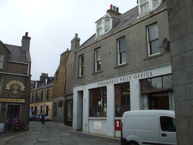
Victoria Street, through the middle of Stromness.
Just past the Post Office is
Brown's Hostel,
a nice place to stay:
+44-(0)1856-850-661
www.brownshostel.co.uk
On 14 October 1939, just over one month after Germany opened the European theatre of World War II, the German U-boat U-47 slipped into Scapa Flow and sank the WWI-era HMS Royal Oak, killing 833 men out of a crew of 1,400. Old and unwanted vessels had been used as "blockships" during World War I, intentionally sunk in many of the eastern approaches to Scapa Flow. However, the sinking of the Royal Oak showed that the blockships were an inadequate defense. The U-47 had entered Scapa Flow through Kirk Sound between Lamb Holm and the Orkney Mainland, and it escaped by the same route after its attack.
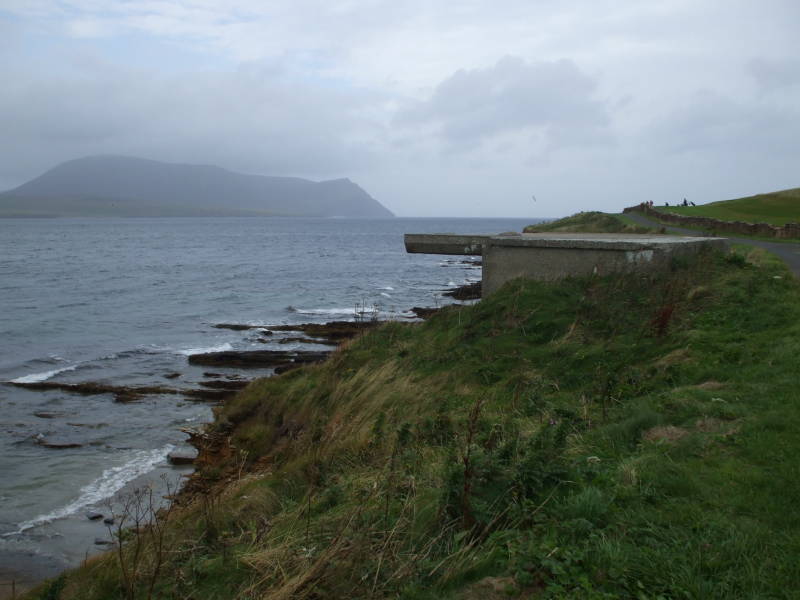
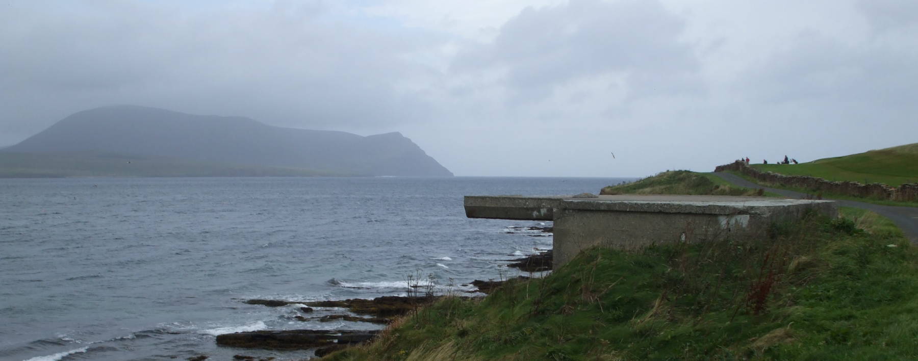
A defensive bunker near the Skerry of Ness, just south of Stromness, looking across Hoy Sound toward the island of Hoy. Scapa Flow is to the left, and the Atlantic starts beyond the opening to the right.
Winston Churchill was the First Lord of the Admiralty when the Royal Oak was sunk. He ordered that causeways be constructed between islands to completely block most of the eastern approaches from the North Sea to Scapa Flow. Construction began in May 1940, and was completed in September 1944. The causeways came to be known as the Churchill Barriers. Now they provide road links, joining several islands by the A961 highway. The barriers total 2.3 kilometers in length.
The Barriers joined the many other defensive structures in Orkney. Some left over from the First World War were re-used, but many more were built.
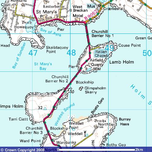
Churchill Barriers #1, #2, and #3, from Mainland to Lamb Holm, Lamb Holm to Glimps Holm, and Glimps Holm to Burray, respectively.
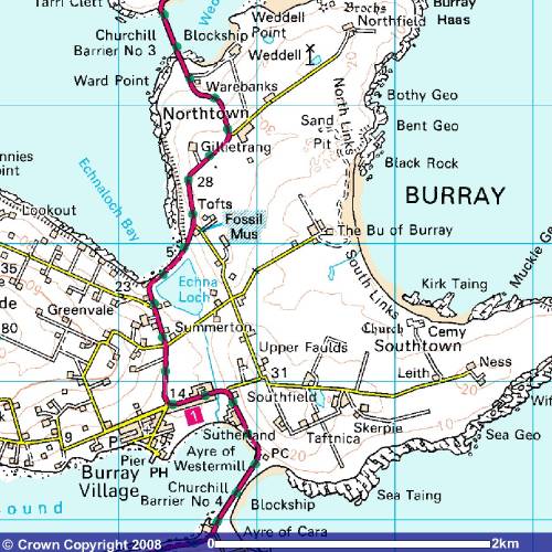
Churchill Barriers #3 and #4, from Glimps Holm to Burray, and Burray to South Ronaldsay, respectively.
For my self-guided tour, I started by taking a bus from Stromness to Kirkwall, and then connecting to another bus heading south onto South Ronaldsay by way of the A961 across Burray.
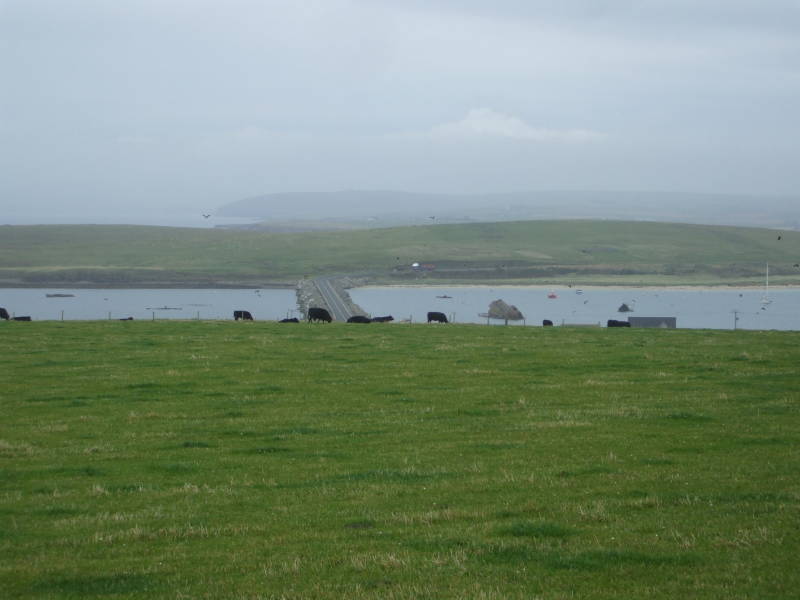
I asked the driver to let me out on the south side of Burray Village, giving me a good view of Barrier #4 crossing over the narrow sound to South Ronaldsay. Then I turned and walked back the way the bus had come.
There isn't much in Burray Village. There are several homes, some offering B&B, but really just the one general store. Residents must travel to Kirkwall to find a Tesco supermarket, building supply places, and other businesses.
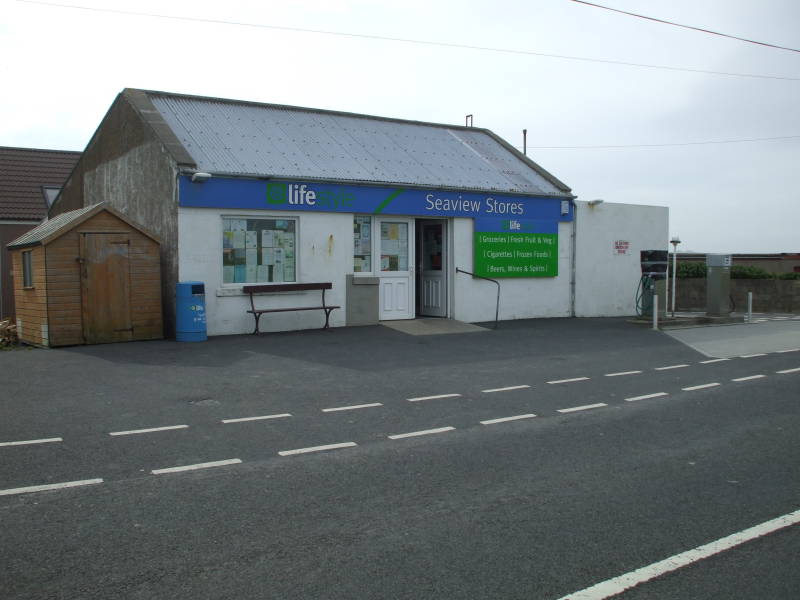
This building makes up almost the entire commercial district of Burray Village.
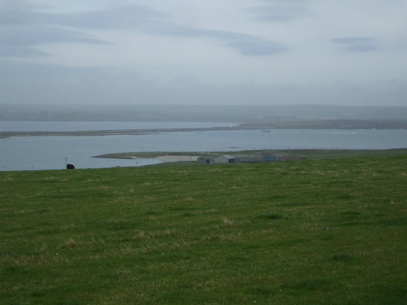
Churchill Barrier #4 crossing from Burray to South Ronaldson.
You can look back and see Barrier #4 as you climb the central hill of Burray. Barrier #4 crosses from Burray to South Ronaldson.
The highest point on Burray is a little over 80 meters elevation.
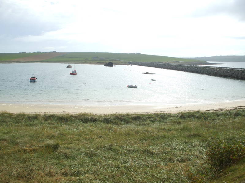
Churchill Barrier #3 crossing Weddell Sound to Glimps Holm.
Once you cross the central hump of Burray, you see Barrier #3 ahead. It crosses Weddell Sound from Burray to a small holm known as Glimps Holm.
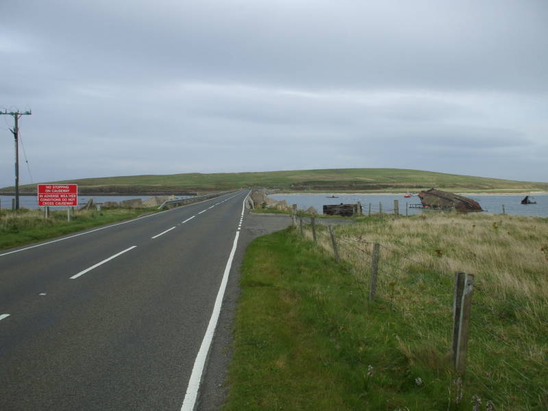
Churchill Barrier #3 crossing Weddell Sound to Glimps Holm.
Some blockships had been used in an attempt to close off Weddell Sound, but Barrier #3 made a complete job of it.
Historical markers along the way explain the history, including the construction of the barriers.
Construction of the Churchill Barriers.
Amazon
ASIN: 1843410052
Amazon
ASIN: B01N1WAS2S
The causeways were started with cages of locally quarried stone dropped into the water. Large concrete blocks were placed on top of those. Five-ton blocks were stacked to form the cores of the causeways, and then ten-ton blocks were placed in random orientations to break the waves.
The top surface was eventually filled in with small stone aggregate and roads were built across the causeways.
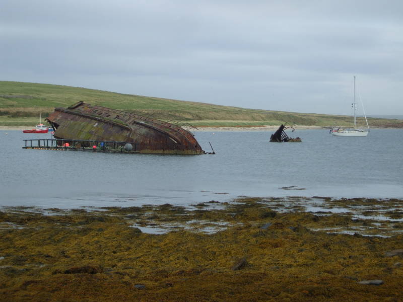
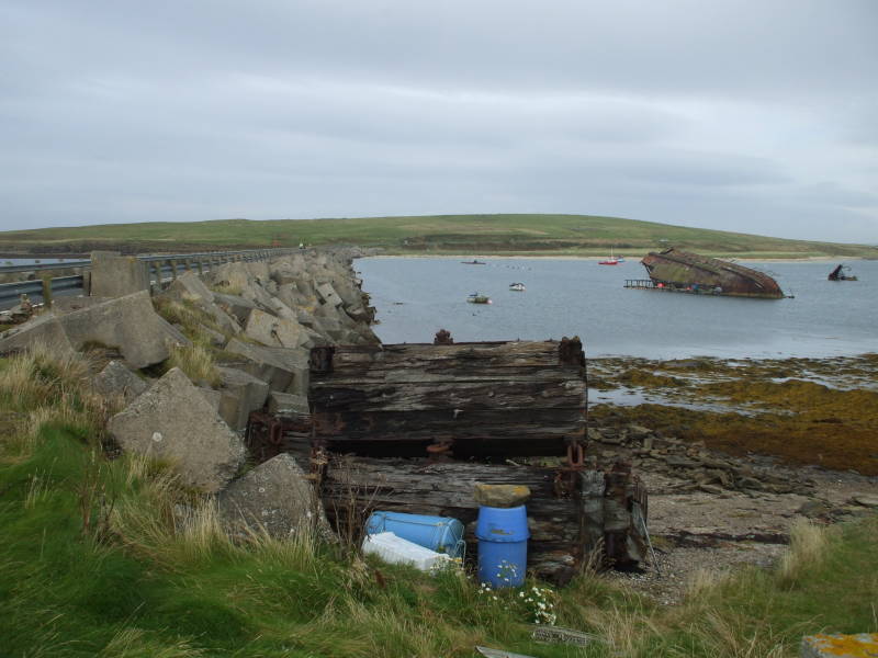
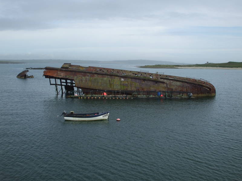
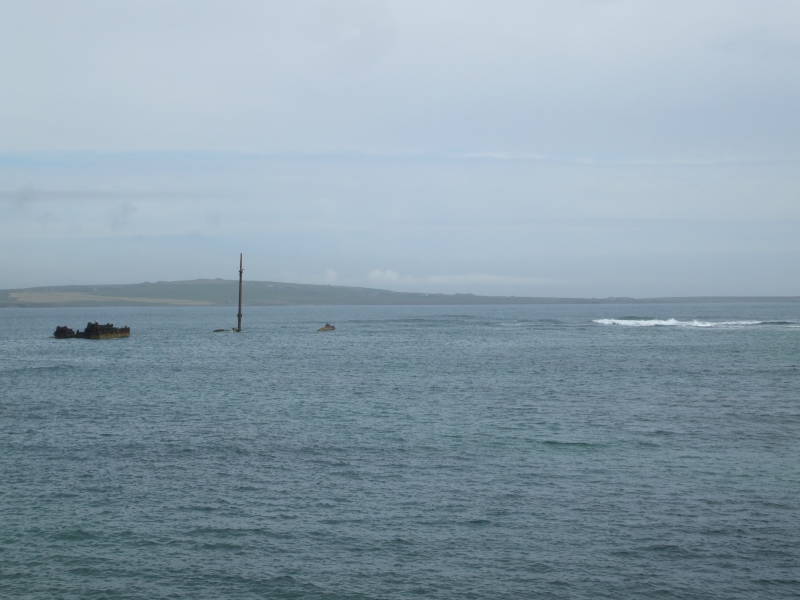
Old blockships beside Churchill Barrier #3.
The blockships are decaying in place, providing marine habitat and plenty of fishing opportunities.
A bunker is visible on the northern tip of Burray, guarding Holm Sound.
Another bunker is visible in the distance here, near the northern tip of Burray. It overlooks Holm Sound, previously a large entrance from the North Sea to Scapa Flow between Mainland and Burray.
In the far distance across Holm Sound you see the southern tip of Mainland.
A closer view of that bunker on Burray, overlooking Holm Sound. The southern tip of Mainland is visible at left. Beyond that is the North Sea.
Winston Churchill was First Lord of the Admiralty during the First World War, until the disaster of the Gallipoli Campaign in 1915. He resigned from government in November of 1915, and served several months on the Western Front as a Colonel commanding the 6th Battalion of the Royal Scots Fusiliers. He returned to government service two years later, as Minister of Munitions, and one year later in 1919 became Secretary of State for War and Secretary of State for Air.
He was reappointed First Lord of the Admiralty soon
after Germany started World War II in Europe at
the first of September, 1939.
The Board of the Admiralty famously sent a signal to
the entire Royal Navy Fleet:
WINSTON IS BACK.
Looking back from Glimps Holm, over the blockships, fishing boats, and Churchill Barrier #3 to Burray.
After Germany's advance through the Netherlands and Belgium and its invasion of France, the U.K. clearly had no more confidence in Chamberlain and he resigned as Prime Minister in May, 1940. King George IV then asked Churchill to serve as Prime Minister.
There are blockships on both sides of Barrier #3. Some are capsized in fairly shallow water, with quite a bit visible above the waterline.
Barriers #2 and #1 are longer, spanning about 700 to 800 meters each. They're each roughly twice the length of #3 or #4.
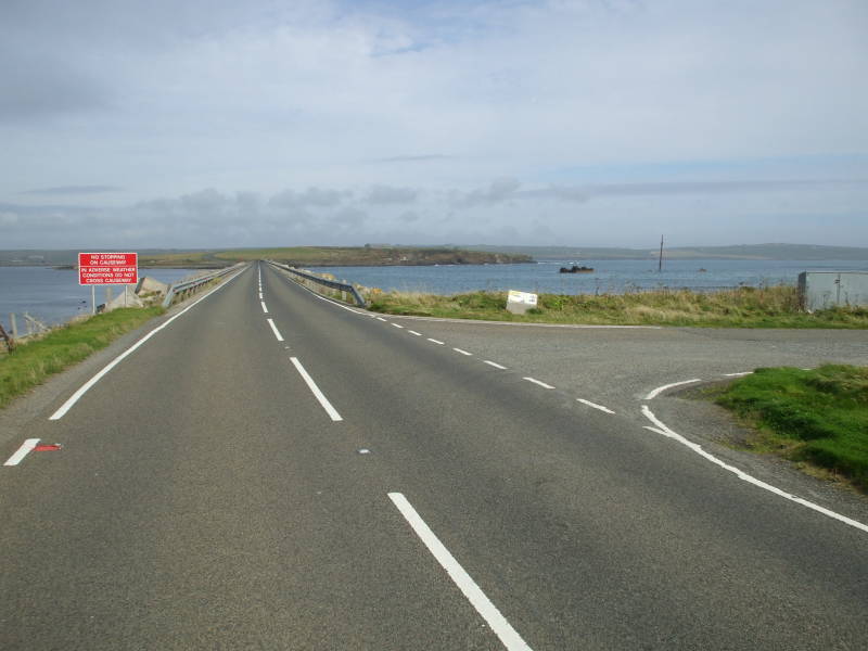
The red signs at the ends of the causeways say:
IN ADVERSE WEATHER CONDITIONS DO NOT CROSS CAUSEWAY
Remember, that the North Sea is just out through that opening to the right in this view. Adverse weather conditions here can get very adverse indeed, including waves that wash across the causeways.
Churchill Barrier #2 crossing Holm Sound from Glimps Holm to Lamb Holm.
The blockships on the seaward side of Barrier #2 are resting upright on the bottom with their upper surfaces just barely awash.
Glimpsholm Skerry, a skerry being rocks that just break the surface, is also to the seaward side of Barrier #2.
One of the World War I blockships in Holm Sound, near Churchill Barrier #2.
Lamb Holm was the site of one of the quarries providing the stone used to build the causeways. There's also a grass airstrip, and of course, more bunkers.
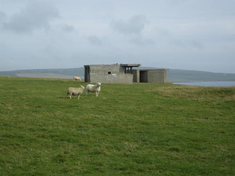
A larger bunker on Lamb Holm overlooking Holm Sound.
Construction required a labor force that peaked at over 2,000. Much of the labor was provided by a force of over 1,300 Italian prisoners of war who had been captured in North Africa.
The Geneva Conventions prohibited the use of POW labor for war effort, but the Germans and Japanese clearly paid no attention as seen by their brutal slave labor camps. The British put the Italian POWs to work here building the purely defensive causeways. The work was officially described as "improvements to communications" to the southern islands, and as things turned out, that's all the barriers really accomplished. They weren't officially opened until 12 May 1945, four days after the end of World War II in Europe.
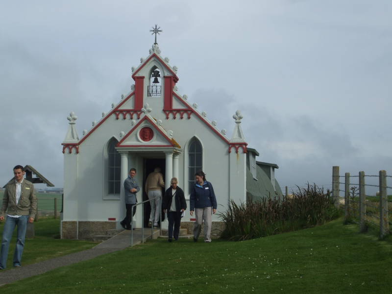
Exterior of the Italian Chapel on Lamb Holm.
The Italian POWs had pretty good living conditions, probably better than what they had experienced in the North African campaign, and they were certainly treated much better than the POWs and slave laborers held by Germany and Japan.
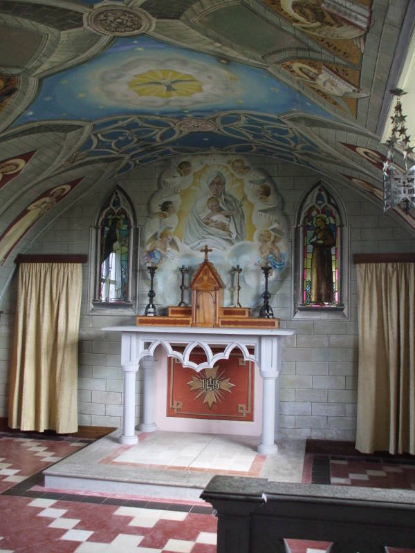

The British gave the POWs two unused Nissen Huts and allowed them to use leftover building material. Led by an artist among them, the 600 POWs at Camp 60 joined the two half-cylindrical structures end to end and built an ornate chapel that still remains as a tourist attraction. The elaborate exterior facade and the altar area are made from concrete. Trompe l'oiel painting inside makes the painted panels masquerade as dressed stone work.
History
Travel
The Royal Navy left Scapa Flow in 1956. But Scapa Flow has recently become more active again with a major oil terminal on the relatively small island of Flotta.
The former Royal Navy base has been turned into an oil terminal. Pipelines from North Sea oil fields arrive here. A 30-inch pipeline runs 128 miles from the Piper oilfield to Flotta, with oil from the Claymore and Tartan oil fields also feeding in. The oil is stored in huge tanks until it can be safely loaded in the gigantic tankers used to transport petroleum products.