Loire River Valley
The Loire River
The Loire river starts in the Cévennes highlands along the southeastern area of the Massif Central, between St. Etienne and Nîmes. It flows north, parallel and quite close to the Rhône past Lyons, and then curves to the northwest. It reaches its northernmost point near Orléans and then runs roughly west through Amboise, Tours, Saumur, and Nantes.
The upper Loire once continued north before it reached the area of present-day Orléans to join with the predecessor of the Seine. The lower Loire of that era started near the location of present-day Orléans. Tectonic uplift during the Pleistocene epoch (about 2,588,000 to 11,700 years ago) changed the course of the paleo-Loire-Seine river [see here and here]. The upper Loire changed course and joined the formerly independent lower Loire to form one long river.
Humans have lived along the Loire since 40,000 to 90,000 years ago in the Palaeolithic period. Neanderthal inhabitants used stone tools to form tree trunks into boats. Anatomically modern humans arrived around 30,000 years ago. By about 5000 to 4000 BC they were cutting down trees to raise crops and livestock along the river.
MarseilleGreek settlers from Phocaea founded a colony on the Mediterranean around 600 BC. They called it Μασσαλία, which we spell Massalia or Massilia. Today it's Marseille.
The Phoenicians and Greeks sailed up the Rhône from the Mediterranean coast near Massalia to the site of today's Lyons. They used horses to carry goods west from there over the relatively short distance to the Loire. They then sailed from there to the river's mouth at the Atlantic coast and back, joining the Mediterranean to the Atlantic mostly by boat with just a short overland connection by horse.
This trade between Greece and the Celts made Massalia quite wealthy. It was the first Greek settlement given the status of πολίς (that is, polis or city) in the territory of what is today's France. The colony established the Treasury of Massalia at Delphi, the major religious center back in central Greece.
The Romans came in next, subduing the Gauls in 52 BC. After 16 AD the Loire river valley became part of the Roman province of Aquitainia.
By 400 the Roman Empire was fading away. The Franks and Alemanni moved into the area from the east. An Iranian tribe calling themselves the Alan, their dialect's pronunciation of Aryan, had migrated out of central Asia in the 1st century to occupy an area between the Don river and the Caspian sea. Josephus mentioned them: "Now there was a nation of the Alans, which we have formerly mentioned somewhere as being Scythians, and inhabiting at the Lake Meotis." They crossed the Rhine in 406 with the Vandals and Suebi, and a large group of them settled along the middle Loire in 408. After the end of the 5th century the Alans were absorbed into the warring Franks and Visigoths. Many place names in today's France are related to "Alan", as are many family names "Allaines" around Orléans. The personal name "Alan", which comes from Brittany, seems to also come from these Iranian people.
Norsemen inNormandy
The Norse began raiding the west coast in the 9th century. The Old Norse word víkingr has to do with the activity of raiding, and didn't originally refer to the people doing the raiding. But the Norsemen did a lot of víkingr. They went up the Loire in their longboats to Tours (destroyed in 853) and Angers (destroyed in 854 and 872).
The lower Loire was the border between the French and the English during the Hundred Years' War, which actually went on for the 116 years from 1337 to 1453.
We stayed at the Hotel le Volney in Saumur.
There is frequent passenger rail service to Saumur. But be aware that the train station is on the north side of the very wide Loire river, putting it a kilometer away from the center of the city.
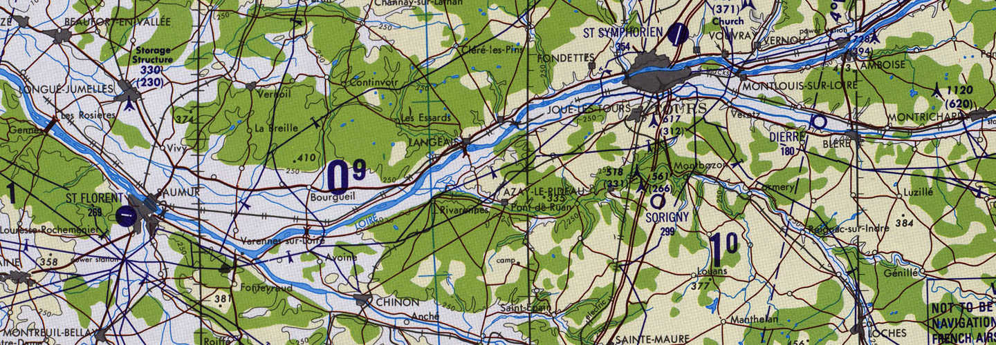
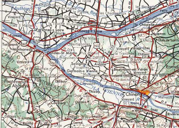
See the below map from the Perry-Castañeda Map Collection. We will travel upriver to Fontevraud, near where the Vienne joins the Loire, and then continue up the Vienne to Chinon. Another day we will drive along the Loire through Tours to Amboise and the Château de Chenonceau built along the Cher river between Blére and Montrichard, southeast of Amboise. We will go south from Saumur to Montreuil-Bellay, and then to the northwest from Saumur downstream along the Loire as far as Gennes, visiting Saint-Hilaire-Saint-Floret and Chênehutte-Trèves-Cunault.
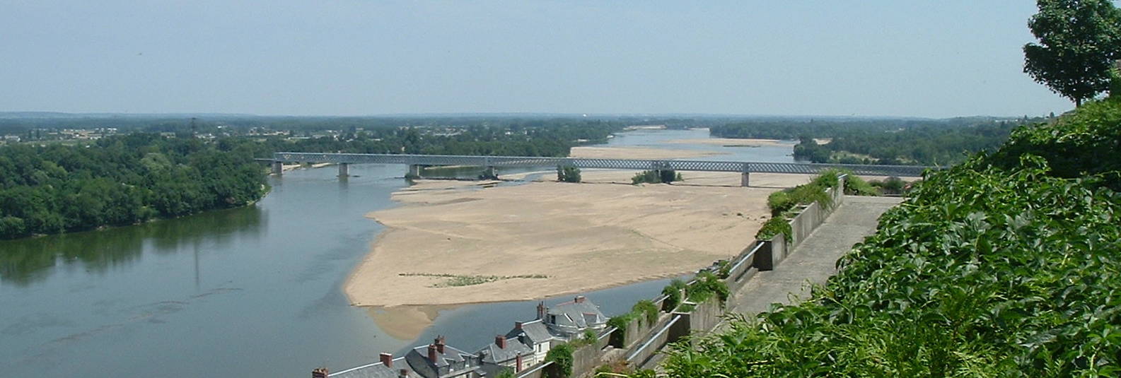
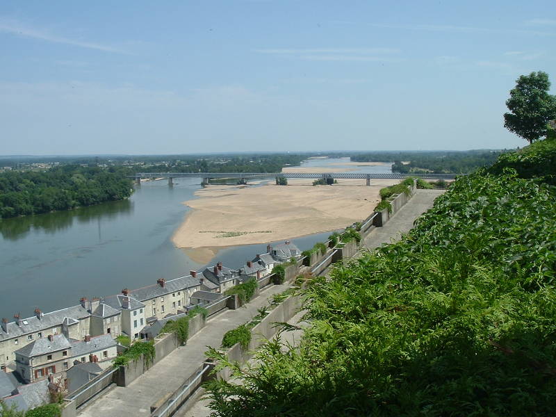
The Loire, Rhône, and Seine are still used for transport today, although the railroads began competing for freight business in the 1840s. Canals such as the Canal Latéral à la Loire provided efficient water transport without the problems caused by fluctuating river water levels and shifting channels and sandbars. The name Loire comes from the Latin Liger, which is from the native Gaulish or Celtic name Liga, which means silt, sediment, or deposit. Today the Loire is officially navigable only as far upstream as Bouchemaine (as in Maine-Mouth), where its tributary the Maine river joins the Loire near Angers. Below is a view of the broad, shallow, slow-moving Loire at Saumur.
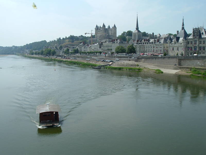
Saumur
Neolithic and Chalcolithic (that is, Late Stone Age and Copper Age) people built megalithic structures around Saumur in the period 3000-1200 BC. One of them now just outside Saumur is 17.3 meters long by 5.4 meters wide and 3.1 meters high. It is the largest dolmen in France, the largest in all of Europe in terms of enclosed volume, and the second longest in Europe.
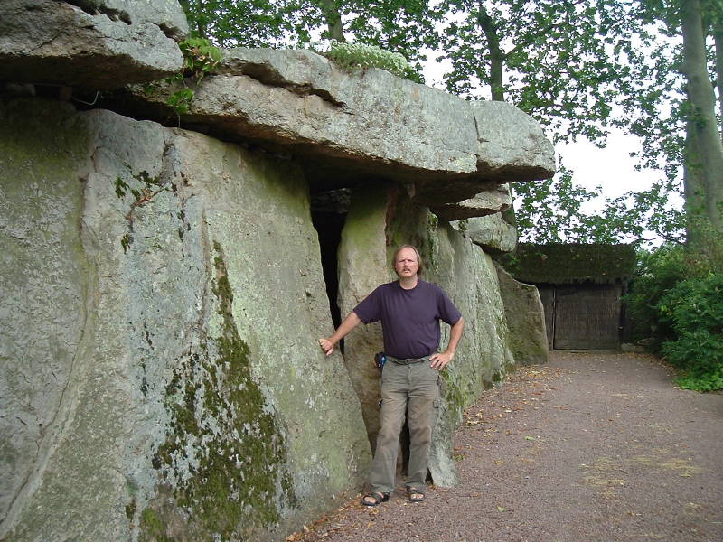
The dolmen at Saumur, the largest in France.
Amazon
ASIN: 0415152046
Amazon
ASIN: 085224441X
There was very little sign of a settlement at Saumur's location on the Loire before the Dark Ages. It emerges out of complete obscurity when the Norse leader Hasting sacked the settlement in 845. Of course, that general lack of information is why we call them the Dark Ages.
The nobility began building châteaux or fortresses in the 10th century. Thibaut the Trickster, the Count of Blois and Chartres, built the first version of the Château of Saumur in 960 to defend against Norse raids coming up the Loire. In the late 900s Gelduin, the lord of Saumur, was a vassal of the Counts of Blois, making the town an enemy of Fulk III, the Count of Anjou. The château was destroyed in 1067, and then rebuilt by Henry II of England in the late 12th century.
The French kings began building structures after the Hundred Years' War that were fortresses but with aesthetic embellishments. The nobility wanted to be near the source of power, so more construction started. The architects competed to build ever more lavish châteaux. Now over 300 major châteaux lie near the Loire from Nevers downstream.
Saint Louis added reinforcements to the Château of Saumur in 1227. Louis of Anjou replaced the earlier round towers with octagonal ones in 1367. King René of Anjou (1409-1480) made significant improvements to the entire complex, as the Italian Bartolomeo did in the 1500.
The Château of Saumur was converted to an army barracks in 1621. It was then converted into a national prison under Napoleon Bonaparte, and then into an ammunition depot.
Montsoreau
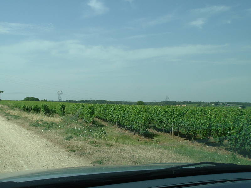
We're cutting through some back roads on our way from Saumur to Fontevraud across the higher ground above Montsoreau. The Loire Valley wine region includes 87 appellations under the systems of Appellation d'origine contrôlée or AOC, Vin Délimité de Qualité Superioeure or VDQS, and the Vin de pays. The wines are mainly white, from the Chenin blanc, Sauvignon blanc, and Melon de Bourgogne grape strains.
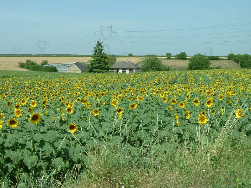
Large sunflower farms are also located throughout the area.
Saumur is just off the west edge of this map. Montsoreau is along the south bank of the Loire just downstream or west of where the Vienne joins it. Fontevraud l'Abbaye is south of Montsoreau. Chinon is further upstream along the Vienne, to the east and a little south. In the coming sections we will visit Fontevraud l'Abbaye and Chinon and then stop for dinner at Montsoreau on the way back to Saumur.
Note that you sometimes see Fontevrault in English as in some of these maps, and that is an older name for the commune, but the name of the abbey and current name of the location is Fontevraud.
Now let's visit the abbey where Eleanor of Aquitaine,
Henry II, and Richard Lionheart are buried.
Next ❯
Fontevraud Abbey